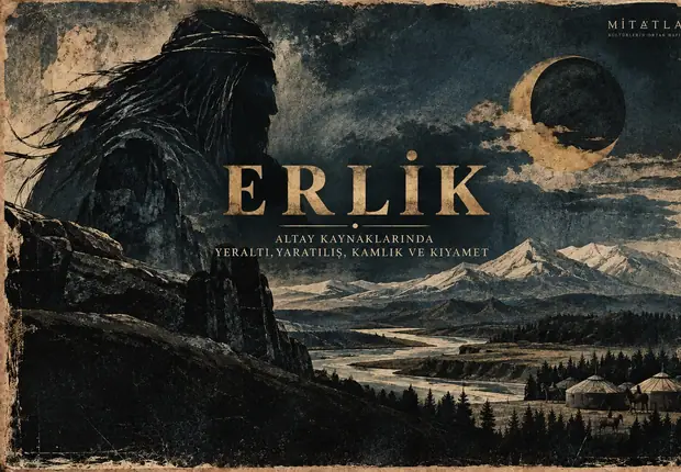

Ötüken is often reduced today to a familiar phrase: “the sacred mountain of the Turks.” That description is not entirely baseless, but it is too narrow.
When the Old Turkic inscriptions, Chinese dynastic histories, Uyghur qaghanate inscriptions and the archaeology of the Orkhon Valley are read together, Ötüken emerges not as a single mountain but as a much more complex historical geography.
In the eighth-century inscriptions, Ötüken appears as the center where the qaghan should remain, the place where the el—the political realm—could be maintained, a sacred geography, and a strategic center connected with movement beyond the heartland. The Uyghur inscriptions of Tariat and Šine-Usu go further: they refer to the middle, north and western end of Ötüken; qaghanic örgins are established there, and the landscape is used seasonally for summering and wintering. Chinese sources record the same broad geography under several different transcriptions and discuss it in connection with the qaghan’s court, ritual locations and political frontiers. S1; S2; S3; S4
The central question, then, is not simply “Where was Ötüken?”
It is:
What kind of place was Ötüken in the historical sources—a single mountain, a broad region, a sacred homeland, a political center, or several of these at once?
MitAtlas approaches that question by separating the evidence by period and source type rather than forcing everything into one modern definition.
In brief: what was Ötüken?
Ötüken was a central historical geography in the early Turkic and Uyghur worlds.
In the Orkhon inscriptions, the qaghan’s residence there is linked with the stability and continuity of the realm. One passage describes Ötüken as the place where the el should be maintained; another explicitly refers to “sacred Ötüken yïš.” S1
The Tariat and Šine-Usu inscriptions of the Uyghur Qaghanate refer to the middle, north and western end of Ötüken. That language makes it difficult to understand Ötüken as only one summit. S2; S3
When the primary texts, Chinese records and modern studies of historical geography are considered together, the broadest framework that best fits the evidence in this article is the Khangai–Orkhon–Tamir system of central Mongolia. Even so, the location of Ötüken’s core remains disputed. Scholars have variously emphasized the Otgon Tenger area, the western margins of the Orkhon Valley, or the wider Khangai system. S5; S6
For that reason:
Identifying Ötüken with one modern mountain, one city or one exact point would go beyond what the surviving evidence securely allows.
1. How does Ötüken appear in the earliest Turkic sources?
To understand why Ötüken mattered, it is better to begin with the Old Turkic inscriptions rather than with a modern map.
Tonyukuk: moving toward Ötüken
In the Tonyukuk inscription, Ötüken appears as the geography toward which the restored Turkic political center moves.
Around T15, Tonyukuk states:
... ötükän yïšγaru uduztum ...
The phrase describes movement toward Ötüken yïš. A few lines later, the Turkic qaghan and the Turkic people are brought to Ötüken; once news spreads that they have settled there, groups begin arriving from different directions. S1
Ötüken in this context is not merely an abstract symbol of holiness.
It is a real center toward which people and political power gather.
Kül Tigin and Bilge Qaghan: “the place to hold the realm”
One of the most important Ötüken passages appears on the south face of the Kül Tigin inscription:
KT S3–4
Türk qaγan ötükän yïš olursar eltä buŋ yoq ... ötükän yïšda yeg idi yoq ärmiš; el tutsïq yer ötükän yïš ärmiš ...
Translations differ in detail, but the central structure is clear.
The Turkic qaghan’s remaining at Ötüken is linked with the absence of distress in the realm, and Ötüken is then described as the “place where the realm should be held.” S1
This is one of the clearest textual foundations for Ötüken’s political importance in the early Turkic world.
The passage should not, however, be forced into a later fully systematized political doctrine.
What the inscription directly tells us is more limited—and more useful:
Ötüken was regarded as a privileged center for the qaghan and for maintaining the realm.
Why it held that position becomes clearer when geography, politics, movement and sacred status are considered together.

Do the sources speak only of “Ötüken yïš”?
No. This distinction is important.
Early Turkic and Uyghur texts do not refer to Ötüken only in the fixed expression Ötüken yïš. Tonyukuk also contains Ötüken yer, while the Tariat inscription uses Ötüken eli. S1; S2
These expressions should not be treated as perfect synonyms.
Taken together, however, they strengthen the argument that Ötüken could function as the name of a broader geography rather than only a single forested place or mountain peak.
In particular:
- el belongs to the semantic field of a political territory or realm;
- yer is a more general word for place or land;
- yïš is a historical landscape term whose precise modern equivalent requires separate discussion.
For that reason, this article will not build a chain such as:
Ötüken = yïš = forest = one single place.
Each form has to be interpreted in its own textual context.
2. “The place to hold the realm”: why was Ötüken politically central?
Explaining Ötüken only through sacredness would narrow what the inscriptions actually tell us.
The Kül Tigin inscription recounts Bilge Qaghan’s campaigns across a wide geographical horizon and then states that there was no better place than Ötüken and that the realm was to be maintained there. The same narrative also reflects on relations with China: its “sweet words” and “soft silk” could draw distant peoples closer, while abandoning the political center could lead to disaster. S1
Another important passage places residence at Ötüken in the same context as sending arkïš tirkiš. In Talat Tekin’s translation tradition, this expression is rendered in the semantic field of caravans or traveling groups; lexical studies likewise connect arkïš tirkiš with caravan or convoy movement. S1
It would be too modern—and too specific—to turn this into the claim that “Ötüken was an international trade capital.”
The inscription supports a more cautious conclusion:
Remaining at the center and being able to send caravans or traveling groups belonged to the same strategy of security, communication and political control.
That strategy may have had economic, diplomatic and logistical dimensions, but arkïš tirkiš should not be reduced to “trade” alone.
Ötüken can therefore be understood as a central geography that:
- gave access to different parts of the steppe,
- allowed relations with China without moving the political core too close to the frontier,
- supported the movement of people and livestock,
- connected with caravan and communication routes,
- and helped preserve the political heartland.
The Orkhon Valley and the Khangai system also provide an ecological setting in which such a center makes sense: water, pasture, river valleys and broad areas suitable for seasonal mobility.
UNESCO’s modern assessment describes the Orkhon Valley as a long-term center of political, commercial, cultural and religious activity. S16
That modern assessment is not a direct translation of an eighth-century inscription. It does, however, provide useful geographical context for understanding why the inscriptions repeatedly insist on remaining in the Ötüken heartland.

3. Why was Ötüken sacred?
We do not need modern reconstructions of “Tengrism” to establish Ötüken’s sacred character. The early Turkic text itself provides direct evidence.
On the east face of the Kül Tigin inscription appears the expression:
KT E23
ïduq ötükän yïš ...
—that is, “sacred Ötüken yïš.” S1
The word ïduq clearly belongs to the semantic field of “sacred” or “consecrated.” Ötüken’s sacred status is therefore not a later invention.
But the word “sacred” should not be expanded beyond what the source can support.
This phrase alone does not prove:
- that Ötüken itself was a deity,
- that there was one single temple at Ötüken,
- that all Turkic communities practiced the same ritual there,
- or that Turkic Ötüken was certainly identical with the Mongolian earth figure Etügen.
When the evidence is considered together, Ötüken can reasonably be discussed as a sacred central geography. That is an evidence-based synthesis, not a single dictionary definition contained in the inscription itself.
Within the same broad historical world, sacred land and water, Tengri, qaghanic authority and particular homelands or territories could all intersect. Yet turning all of those elements into one fixed and universal theological system would require evidence we do not have.
4. Dujin in Chinese sources: the qaghan’s court, ancestors and heaven ritual
Alongside the Turkic inscriptions, Chinese dynastic histories preserve a different kind of evidence for Ötüken.
The name appears under different transcriptions in different periods. Early records contain forms such as 都斤 / 於都斤, often rendered in modern scholarship as something like Dujin; Tang-period sources use forms such as 鬱督軍 and 烏德鞬, conventionally compared with Ötüken. S4; S5
These spellings should not be flattened into one timeless “Chinese name of Ötüken.”
The qaghan resides at Dujin
The Turkic biography in the Zhou Shu states:
可汗恒處於都斤山
The qaghan is said to reside at Dujin mountain or region.
The text then adds:
牙帳東開
—his royal camp or court opens to the east—and explains this with reference to respect for the direction of sunrise. S4
The Bei Shi transmits substantially similar information. Since the two works share much of the same early historiographical tradition, they should not be counted as two wholly independent observations.
The Sui Shu also places Shabolüe/Shetu Qaghan’s center at Dujin and uses Dujin as a geographical reference for the eastern limit of the Western Turkic realm. S4
Read together with the Old Turkic inscriptions, these records reveal an important overlap:
Ötüken/Dujin appears in both Turkic and Chinese traditions as a central geography of qaghanic power.
At the same time, we should not assume that Chinese transcriptions always indicate precisely the same geographical scale.
An early Dujin record may refer to the qaghan’s central mountain region, while later Yudujun/Wudejian forms can describe political focal areas within the same broader central geography. S4; S5
In other words:
continuity of the name does not prove that every source points to the same small location.
Was the ancestral cave itself Ötüken?
The Chinese source also describes an annual ritual at an ancestral cave.
Popular retellings sometimes turn this into “the sacred cave of Ötüken.” The original evidence is more restrained.
The qaghan’s residence at Dujin and the ancestral-cave ritual belong to the same political-cultural setting, but the text does not say that the cave was the single summit or central point of Ötüken. S4
The same caution applies to the heaven ritual in the middle of the fifth lunar month.
The source states:
五月中旬集他人水拜祭天神
The gathering is associated with a watercourse or water-site written 他人水.
Some modern scholars have proposed identifying this name with the Tamir River. That is a philological and geographical hypothesis; the Chinese text itself does not simply say “Tamir.” S4; S5
For that reason MitAtlas will not use the simplified sentence:
“Every May the Turks climbed the summit of Mount Ötüken and sacrificed to Heaven.”
The surviving source says something more complicated.
It also mentions, west of Dujin, a separate high and treeless mountain whose name is written 勃登凝黎, explained in the Chinese account in relation to an earth deity or earth spirit. S4
This matters because the following should not automatically be collapsed into one sacred spot:
- Dujin/Ötüken,
- the ancestral cave,
- the fifth-month ritual site at 他人水,
- and the separate western mountain 勃登凝黎.
They belong to the same wider ritual and political landscape, but the source preserves distinctions between them.
5. What does “Ötüken yïš” mean?
One of the most difficult words in the Ötüken debate is yïš.
For a long time, translations such as “Ötüken Forest” became common. That rendering has a serious philological basis, but it should not be treated as though the question were completely settled.
Osman Fikri Sertkaya compares the runic spellings yıs / yïš / yis / yiš with cognates in modern Turkic languages. Forms in Sakha, Khakas, Shor and Kyrgyz strongly support a semantic connection with forest. S7
Gerard Clauson, however, does not reduce the word to a simple flat “forest.” He places it in the semantic field of “mountain forest”—a wooded upland or mountain landscape that can also include grassy valleys and open areas within the same terrain. S8
The eleventh-century evidence in the Dīwān Lughāt al-Turk complicates the picture further. Yïš appears in topographical vocabulary associated with slopes or descending terrain, and Clauson himself notes that Kashgari’s evidence is not entirely straightforward. S8; S14
Modern scholars have developed these observations in different directions.
Osman Karatay accepts the basic forest-related meaning but argues that, in the specific expression Ötüken yïš, the word may have expanded toward a broader sense of land or region. Kahar Barat compares yïš with yazï—open plain—and interprets it as a habitable, grazeable mountain slope or upland pastoral zone. S5; S9
Fatih Şengül proposes a much more radical reinterpretation, suggesting that Ötükän Yıš could be understood in the direction of “Ötüken city/province.” This is an interesting modern hypothesis, but it has not displaced the classical philological interpretation. S10
For that reason, this article will preserve Ötüken yïš on first occurrence and explain it rather than forcing one English equivalent.
The safest formulation is:
Yïš is commonly translated in classical scholarship within the range “forest, mountain forest, wooded upland,” but its precise historical sense and its function in the expression Ötüken yïš remain debated.

6. Where does the name Ötüken come from?
Just as yïš is disputed, the etymology of Ötüken is unresolved.
Erhan Aydın attempts to explain the name through a Turkic verbal base ötü- together with derivational suffixes. He also discusses a possible relationship between Turkic Ötüken and Mongolian Etügen / Ötügen. S6
The Mongolian comparison has a long history.
Vladimirtsov and other early scholars drew attention to Mongolian Etügen/Ötügen, used in semantic fields involving the earth, the world, Earth Mother or an earth divinity, and tried to relate it to the Turkic place-name. S12
But similarity in form and cultural association is not enough to prove direct identity.
Other explanations have also been proposed.
Turgay Sebzecioğlu starts from the Turkic verb öt- “to pass” and interprets the name in the direction of “passes” or a “main gateway.” S11
Fatih Şengül takes a different route, interpreting ötü in the direction of “old/ancient” and kän as “city,” producing an approximate “old/ancient city” explanation. S10
These proposals are not simply minor variants of one solution; they represent genuinely different etymological models.
That diversity leads to one secure conclusion:
The etymology of Ötüken is not settled.
MitAtlas will therefore not choose one proposal and present it as the “true meaning” of the name. The competing explanations will be identified as modern scholarly hypotheses rather than as facts contained in the early inscriptions themselves.
7. Where is Ötüken today?
This is one of the most disputed questions in the history of Ötüken research.
The broad Khangai model
Kahar Barat brings together 22 Turkic and 84 Chinese records and argues that Ötüken is better associated with the Khangai mountain system as a whole than with a single peak. S5
One of the strongest reasons for taking this broader model seriously comes from the Uyghur inscriptions.
If a text speaks of:
- the middle of Ötüken,
- its north,
- its western end,
- different river-heads,
- summering grounds,
- and qaghanic örgins,
then a one-summit model becomes increasingly difficult to sustain.
For this article, the combined evidence most safely points to:
a broad central geography associated with the Khangai–Orkhon–Tamir system.
That statement does not mean that all scholars agree on one exact boundary.
The Otgon Tenger hypothesis
Erhan Aydın proposes a narrower localization and argues that Ötüken should be sought around Otgon/Otgon Tenger in present-day Zavkhan. S6
This interpretation gives particular weight to historical place-names, modern toponymy and geographical details in the Uyghur inscriptions.
It does not, however, fit perfectly with the broader Khangai model.
Expressions such as “middle,” “north” and “western end” in the Tariat inscription seem to imply a territory larger than the immediate surroundings of a single summit.
Khotont and the Uyghur capital zone
Tang-period geographical records describe the Uyghur center with Wudejian on its western side. This has led some scholars to connect Wudejian in that specific context with Khotont, west of the Orkhon Valley. S5
This is useful as a localization clue, but it does not justify the absolute equation:
Ötüken = Khotont.
Khotont may instead represent one local face, edge or landmark within the wider Ötüken system as described in relation to the Uyghur capital.
Why can we not draw an exact modern boundary?
Because the historical sources do not function like modern topographic surveys.
Some name mountains.
Others identify river-heads.
Some speak of a “middle,” an “edge” or a seasonal grazing zone.
Chinese histories use changing transcriptions.
And within the same broad heartland, the political focus could shift over time.
For that reason, a MitAtlas map should not draw a hard line and label everything inside it “Ötüken.”
A more accurate visual method would distinguish:
- securely identified source locations,
- the broader Khangai–Orkhon–Tamir zone,
- and competing modern localization hypotheses.
That preserves the historical uncertainty instead of hiding it.
8. How did the Uyghurs use Ötüken?
Ötüken did not lose its central role after the Turkic qaghanates.
The Tariat/Terhin and Šine-Usu inscriptions of the Uyghur Qaghanate describe the same broad heartland with far greater internal detail.
Tariat: western end, middle and north
On the west face of the Tariat inscription, the qaghan describes establishing an örgin at the western end of Ötüken, at the headwaters of the Tez River.
The basic wording includes:
... ötük(e)n k(i)d(i)n uçınta t(e)z b(a)şınta örg(i)n ... S2
Elsewhere the inscription states:
ulu yılka ötük(e)n ortusınta ... y(a)yl(a)d(ı)m ...
—that he summered in the middle of Ötüken. The same narrative also refers to an örgin, enclosure or walling, and commemorative inscriptional activity. S2
Even more important is the expression Ötüken eli.
Ötüken appears together with neighboring territories, rivers, valleys and fields as part of a broad geographical and political landscape. S2
Another passage describes the northern side of Ötüken, with the Tez headwaters toward the west and other river systems toward the east.
Taken together, these passages are among the strongest primary-text arguments against reducing Ötüken to one isolated mountain peak.
Šine-Usu: summering, wintering and the qaghanic center
The Šine-Usu inscription narrates the same political world in a more detailed historical sequence.
Its geography includes:
- wintering,
- summering,
- the Tez headwaters,
- the establishment of an örgin,
- and the construction of an enclosure or wall.
These are not abstract mythological motifs. They belong to the practical organization of a qaghanate landscape. S3
For that reason, Ötüken cannot adequately be described only as a sacred symbol.
It was a real landscape in which people moved, summered, wintered and established political centers.
The relationship between Tariat and Šine-Usu is especially important because the two texts belong to the same Uyghur political world and preserve overlapping geographical traditions. They support continuity in the use of the wider Ötüken heartland without proving that one fixed palace or urban center remained unchanged from the earlier Turkic qaghanates.

Manichaean Ötüken
The religious transformation of the Uyghur period also left traces in the geography.
An Old Uyghur Manichaean fragment contains the expression:
ötükäntäki nom ulugı ...
The phrase refers to a senior religious or doctrinal authority located in Ötüken. S13
This is significant because it directly connects Ötüken with Manichaean religious organization in the Uyghur period.
But chronology matters.
This evidence belongs to the Manichaean Uyghur world. It should not be projected backward as evidence for the religious institutions of the earlier Turkic qaghanates.
9. Was Ötüken a city?
The safest answer is:
There is not enough evidence to define Ötüken itself as the name of a city.
The Old Turkic inscriptions do not identify Ötüken with the urban term balïq. Instead, they describe a geography with internal regions, river-heads, seasonal pastures and an el. S1; S2; S3
That does not mean that the early Turkic world lacked settlements or urban forms.
The word balïq is attested in Old Turkic. Chinese sources also refer in various contexts to palatial, administrative or fortified centers, while archaeology increasingly shows that steppe empires interacted with permanent settlement and production in ways more complex than older “nomad versus city” models suggested.
But none of that proves the statement:
“The fixed Göktürk capital city of Ötüken has been securely identified.”
The Tsagaan Sum / Kök Ordu debate
Some researchers have connected the fortified site of Tsagaan Sum in the Orkhon region with an early Turkic political center, sometimes described as Kök Ordu, and have proposed links with an urban center of Ötüken.
These proposals are important enough to mention, but not strong enough to present as settled archaeology.
Munire Hatamova, in her review of the Ötüken localization problem, draws attention to limitations in publication, archaeological reporting and broader verification surrounding such identifications. S18
For that reason:
Tsagaan Sum remains an interesting archaeological candidate or hypothesis—not established proof that an “Ötüken city” has been found.
This distinction is essential. Rejecting an unproven identification does not mean claiming that early Turkic rulers had no fixed centers. It means only that the specific equation has not been demonstrated securely enough.
10. Ordu-Balıq: a real Uyghur city in the Ötüken heartland
By the Uyghur period, the archaeological evidence for a major city becomes much stronger.
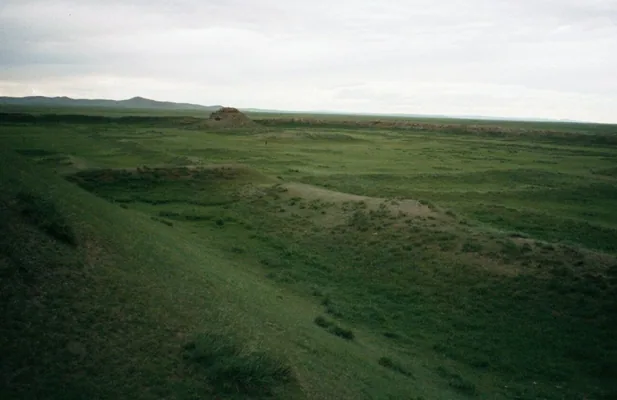
Karabalgasun, historically known as Ordu-Balıq, was a genuine large urban center.
Research by the German Archaeological Institute and Mongolian partners has documented the extent and internal organization of the site. Large-scale drone and photogrammetric survey produced an estimated urban area of roughly 44 km². S17
The importance of this evidence is not limited to size.
Researchers argue that the urban plan should not be understood simply as a copy of Chinese or Sogdian city models. Instead, parts of its spatial logic may reflect the transformation of a mobile steppe camp or ordu into permanent urban form—a distinctive trajectory of steppe urbanism. S17
Excavations in the citadel have revealed features associated with a major center of power, including:
- a large artificial platform,
- monumental gates,
- stone-paved courtyard areas,
- a tower-like central structure,
- a deep well,
- and worked stone and metal objects.
This evidence requires an important correction to older stereotypes:
Mobile or pastoral political traditions and urbanization were not absolute opposites.
Yet the archaeological strength of Ordu-Balıq should not be used to support a different overstatement.
The existence of a large Uyghur city does not prove that Ordu-Balıq was simply the uninterrupted continuation of one fixed Göktürk “Ötüken city.”
The safer conclusion is:
There is strong continuity in the central political geography, but continuity of one identical urban center is not demonstrated with the same strength.
In other words, the wider Ötüken–Orkhon heartland could preserve its central political importance even while the specific forms and locations of royal camps, seasonal centers, fortified sites and cities changed over time.

11. Was Ötüken forgotten after the qaghanates?
The name Ötüken did not disappear from historical memory after the Uyghur Qaghanate collapsed in 840.
Its meaning and function, however, changed.
Dīwān Lughāt al-Turk
In the eleventh century, Mahmud al-Kashgari records Ötüken as:
a place in the Tatar steppes, near the land of the Uyghurs.
In the classical Atalay edition, the entry is found in volume I, p. 138. S14
The shift in emphasis is important.
The eighth-century inscriptions speak of:
- the place where the realm should be maintained,
- the qaghan’s proper center,
- and a sacred political geography.
By Kashgari’s time, Ötüken appears primarily as remembered geography.
That does not mean the name had been forgotten. It means that the political world in which Ötüken functioned as an active qaghanic center had changed.

Kutadgu Bilig and the “Beg of Ötüken”
Yusuf Khass Hajib invokes the words of an “Ötüken begi” in two passages.
KB 1962
negü tir eşitgil ötüken begi sınap sözlemiş sözni yetrüp ögi
In Arat’s translation tradition, the reader is asked to listen to the words of the experienced Beg of Ötüken, one who speaks after careful reflection. S15
The figure appears again in KB 2682 as an authority of wisdom. S15
Who was the “Beg of Ötüken”?
We do not know.
Erdem Uçar’s study devoted specifically to the expression does not securely identify the figure with one named historical ruler. Instead, it considers the possibility that Yusuf Khass Hajib inherited this authority figure through oral tradition rather than directly from a written historical source. S15
There is therefore not enough evidence to equate the “Beg of Ötüken” with Bilge Qaghan or another specific ruler.
The safer conclusion is:
In the eleventh-century Karakhanid world, Ötüken could still evoke not only geography but also an older memory of political authority and wisdom.
Juvayni and the memory of Ordu-Balıq
In the thirteenth century, Juvayni refers to the remains of the old Uyghur capital in the Karakorum region as Ordu-Balıq. S19
This is not a direct thirteenth-century use of the word Ötüken.
It does, however, show that the memory of the old Uyghur political center within the same broader Orkhon heartland continued for centuries.
12. What do we know, and what remains uncertain?
The evidence for Ötüken comes from different kinds of sources, and they do not all carry the same degree of certainty.
What we can say with strong confidence
- Ötüken is directly attested in the early Turkic inscriptions. S1
- The qaghan’s residence there is associated with political stability. S1
- Ötüken is described as the place where the realm should be maintained. S1
- The expression ïduq ötükän yïš directly documents its sacred character. S1
- Chinese sources associate Dujin/Ötüken with the qaghan’s court. S4
- Tariat and Šine-Usu clearly reveal an internally differentiated Ötüken geography. S2; S3
- In the Uyghur period, an Old Uyghur Manichaean text contains ötükäntäki. S13
- Ordu-Balıq/Karabalgasun was a genuine major Uyghur city. S17
- The name Ötüken continued to be remembered in the eleventh century in the Dīwān and Kutadgu Bilig. S14; S15
Strong conclusions that still require modern synthesis
- Associating Ötüken broadly with the Khangai–Orkhon–Tamir system. S5; S16
- Understanding its sacred, political and strategic functions as overlapping within the same central geography.
- Recognizing continuity of the central political geography between the Turkic and Uyghur periods.
These are strong historical syntheses, but they are not single sentences quoted directly from one primary source.
Questions that remain debated
- The exact modern boundaries of Ötüken.
- Whether Otgon Tenger formed its geographical core. S6
- Whether Khotont can be precisely equated with Wudejian in a particular Chinese context. S5
- The single best modern translation of yïš. S7; S8; S9; S10
- The etymology of the name Ötüken. S6; S10; S11; S12
- Whether Tsagaan Sum can be identified with a Göktürk capital at Ötüken. S18
- Whether 他人水 can be securely identified with the Tamir River.
Claims we will not present as established fact
- Ötüken was only one mountain.
- Ötüken was only one forest.
- Ötüken was the name of a city.
- Ötüken was itself a single god or goddess.
- Every May the Turks performed the same ritual on the summit of Mount Ötüken.
- The ancestral cave was the single sacred center of Ötüken.
- Mongolian Etügen and Turkic Ötüken are proven to be identical.
- Uyghur Ordu-Balıq was simply the uninterrupted continuation of the same Göktürk capital city.
Conclusion: more than a mountain
It is easy to describe Ötüken as “the sacred mountain of the Turks.”
The early sources do not fit comfortably inside that formula.
In Tonyukuk, Ötüken is a center toward which the Turkic political community moves.
In the Kül Tigin and Bilge Qaghan inscriptions, the qaghan’s residence there is linked with the continuity of the realm. Ötüken is the place where the realm should be maintained and, at the same time, ïduq—sacred.
In Chinese records, Dujin appears as the geography of the qaghan’s court, while the same wider historical setting also preserves information about ancestor rites, heaven worship and other sacred locations.
In the Uyghur inscriptions, Ötüken has a middle, a north and a western end. Qaghans summer and winter within the landscape and establish örgins. In the Manichaean Uyghur world, a religious authority is described as being located in Ötüken. Later, within the same wider Orkhon landscape, a major city such as Ordu-Balıq emerges.
By the eleventh century, Kashgari records Ötüken as a remembered geographical place, while Yusuf Khass Hajib invokes the “Beg of Ötüken” as an authority of old wisdom.
This long history suggests a conclusion more useful than any one-word definition:
Ötüken was a multilayered imperial landscape in which the idea of the political center was joined to real geography.
Its mountains, river valleys, seasonal pastures, qaghanic örgins, sacred places and later cities may have belonged to different parts of the same historical heartland.
For that reason, the safest way to understand Ötüken is not to imprison it at one point on a modern map, but to follow the broad geography described by the sources and the changing functions that geography acquired over centuries.
Sources and access notes
S1. Talat Tekin. Orhon Yazıtları. Istanbul: Simurg, 1998, 2nd ed. Primary text and translation line for the Ötüken passages in Tonyukuk, Kül Tigin and Bilge Qaghan.
S2. Talât Tekin. “Kuzey Moğolistan’da Yeni Bir Uygur Anıtı: Taryat (Terhin) Kitabesi.” Belleten 46/184 (1982): 795–838. DOI: 10.37879/ttkbelleten.1135223. Used for the western end, middle and northern side of Ötüken, the Tez headwaters and qaghanic örgin contexts.
S3. Erhan Aydın. Şine Usu Yazıtı. Çorum: KaraM, 2007; together with Takao Moriyasu et al., “Šine-Usu Inscription from the Uighur Period in Mongolia: Revised Text, Translation and Commentaries,” Studies on the Inner Asian Languages 24 (2009): 1–92. Used for seasonal occupation, örgin and geographical details in Šine-Usu.
S4. Zhou Shu 周書 50; Bei Shi 北史 99; Sui Shu 隋書 84; together with relevant Tang-period chronicles and compilations. Used for Dujin/Yudujun/Wudejian, the qaghan’s court, ritual descriptions and political-geographical references.
S5. Kahar Barat. “Some Thoughts on Ötükän.” Journal of Old Turkic Studies 2/2 (2018): 7–25. DOI: 10.35236/jots.427326. Used for the synthesis of 22 Turkic and 84 Chinese records and for the broad Khangai model.
S6. Erhan Aydın. “Ötüken Adı ve Yeri Üzerine Düşünceler.” Turkish Studies 2/4 (2007): 1262–1270. DOI: 10.7827/TurkishStudies.234. Used for the Otgon/Otgon Tenger localization and etymological discussion.
S7. Osman Fikri Sertkaya. “Yıs (Yış?)/Yis/Yis/Yiş Kelimesi ve Akrabaları Üzerine.” Selçuk Üniversitesi Türkiyat Araştırmaları Dergisi 13 (2003): 1–10. Used for the historical spellings of yïš and its modern Turkic cognates.
S8. Gerard Clauson. An Etymological Dictionary of Pre-Thirteenth-Century Turkish. Oxford: Clarendon Press, 1972, yïš, p. 976. Used for the “mountain forest” semantic field and historical lexical evidence.
S9. Osman Karatay. “Ötüken Yış: Dağ, Orman ve Ülke.” In Omeljan Pritsak Armağanı, 2007, 131–139. Used for the modern proposal that yïš may have broader territorial force in the expression Ötüken yïš.
S10. Fatih Şengül. “Reinterpretation of Ötükän Yıš Expression in Orkhon Inscriptions.” Journal of Old Turkic Studies 5/2 (2021): 393–402. DOI: 10.35236/jots.964822. Used for the alternative “city/province” interpretation.
S11. Turgay Sebzecioğlu. “Ötüken Sözcüğünün Etimolojisi Üzerine Bir Sav: Geçitler ya da Ana Kapı.” The Journal of Social Sciences 2/2 (2015): 44–52. DOI: 10.16990/SOBIDER.41. Used for the alternative “passes/main gate” etymology.
S12. B. Ya. Vladimirtsov. “Eski Türkçedeki Ötüken Yiş Kelimesi Üzerine.” Türk Dünyası İncelemeleri Dergisi 10/1 (2010): 207–210 [Turkish publication of a 1929 study]. Used for the historical comparison between Turkic Ötüken and Mongolian Etügen/Ötügen.
S13. Hatice Şirin. “Şine Us ve Karabalgasun Yazıtları Üzerine.” Çukurova Üniversitesi Türkoloji Araştırmaları Dergisi 7/2 (2022): 811–830. DOI: 10.32321/cutad.1161152. Used for the Old Uyghur Manichaean record U 168 / T.II.D.173 a2 V° containing ötükäntäki nom ulugı.
S14. Mahmud al-Kashgari. Dīwān Lughāt al-Turk, ed. Ahmet Bican Ercilasun and Ziyat Akkoyunlu; classical Turkish translation by Besim Atalay, I/138. Used for the eleventh-century Ötüken place-name and geographical memory.
S15. Yusuf Khass Hajib. Kutadgu Bilig, ed./trans. Reşid Rahmeti Arat; together with Erdem Uçar (2018), “Kutadgu Bilig’de Geçen Ötüken Begi Üzerine Bazı Tespitler,” Dede Korkut 7/17: 106–114. DOI: 10.25068/dedekorkut250. Used for verses 1962 and 2682 and for the modern discussion of the “Beg of Ötüken.”
S16. UNESCO World Heritage Centre. “Orkhon Valley Cultural Landscape.” World Heritage List, no. 1081rev; inscribed in 2004. Used for the long-term political, commercial, cultural and religious landscape of the Orkhon Valley.
S17. Christina Franken, Hendrik Rohland, Marco Block-Berlitz, Tumurochir Batbayar & Ulambayar Erdenebat. “Remote Sensing of Large-Scale Areas at the Urban Sites of the Mongolian Orkhon Valley Using Low-Cost Drones. Preliminary Results and Some Thoughts on the Urban Layout of the Uyghur Capital Qara Balǧasun.” Journal of Global Archaeology (2020): 1–28. DOI: 10.34780/joga.v2020i0.1012. Used for the roughly 44 km² urban plan of Karabalgasun and the interpretation of steppe urbanism.
S18. Munire Hatamova. “Ötüken.” Genel Türk Tarihi Araştırmaları Dergisi 2/4 (2020): 321–332. Used for localization debates, early-city questions and the limits of the Tsagaan Sum/Kök Ordu hypothesis.
S19. Toshio Hayashi. “Karabalgasun i. The Site.” Encyclopaedia Iranica (2010); together with Juvayni, History of the World Conqueror, trans. John A. Boyle. Used for Ordu-Balıq/Karabalgasun and its later historical memory.
MitAtlas method note: Primary inscriptions, Chinese chronicles, eleventh-century lexicographical and literary sources, archaeological evidence and modern philological or historical-geographical theories do not carry the same evidential weight. Direct historical attestation, modern localization and etymological hypotheses are kept separate wherever possible.